Looking for design inspiration? Shop our curated collections!

Boundary: Bleed area may not be visible.


by Nicoolay
$48.00
Size
Orientation
Material
Image Size
Product Details
Our luxuriously soft blankets are available in two different sizes and feature incredible artwork on the top surface. The bottom surface is white. Our 100% polyester blankets are available in two different styles: plush fleece and sherpa fleece. Plush fleece blankets are soft and fluffy on both sides, whereas sherpa blankets are smooth like a soft sweater on the artwork side (i.e. shorter threads) which provides for a sharper image. Looking for a recommendation? Go with a 60" x 80" plush fleece blanket. It's soft and luxurious on both sides... the artwork looks incredible... and the size is just right for everyone.
Design Details
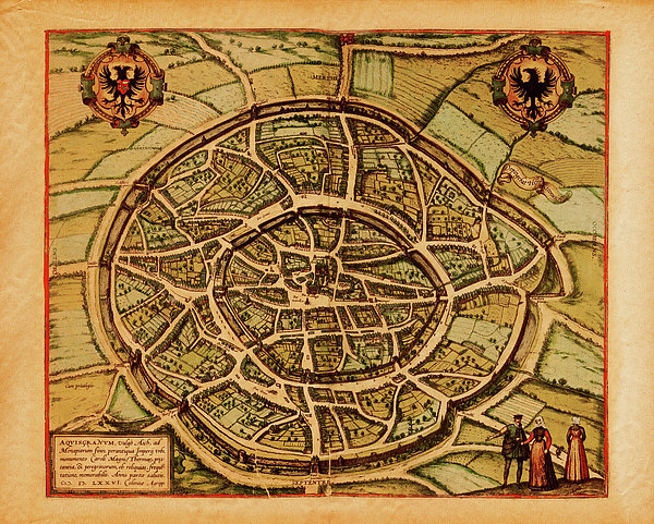
Antique illustration depicting Wien, Austria. Print published by Braun and Hogenberg in Civitates Orbis Terrarum in 1575. Photo by N. Staykov... more
Care Instructions
Machine wash cold and tumble dry with low heat.
Ships Within
1 - 2 business days
Antique illustration depicting Wien, Austria. Print published by Braun and Hogenberg in Civitates Orbis Terrarum in 1575. Photo by N. Staykov (2007)
Image provided by Getty Images.
$48.00


There are no comments for Medieval Maps And Illustrations I View. Click here to post the first comment.